Crime & Safety
Winter Weather Advisory In Effect Until Thurs. Morning
National Weather Service says area could see between 2 to 4 inches of snow.

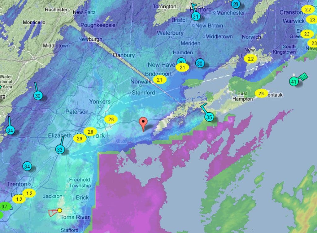

The nor'easter hitting our area with high winds and some coastal floods has brought in enough snow and cold air for the National Weather Service to issue its first Winter Weather Advisory for the 2012-2013 winter storm season.
The advisory calls for high winds between 30 and 40 mph, with gusts up to 60 mph, and falling snow to continue throughout the evening before winding down tomorrow morning. With the sun down, snow has started sticking to roads and sidewalks, creating hard transportation issues.
Visibilities are also down to between a quarter to a half of a mile, creating close to, but not official, blizzard conditions. (Blizzards require winds to be >35 mph, visibility below 1/4 of a mile and conditions to continue for three hours.)
Find out what's happening in Babylon Villagewith free, real-time updates from Patch.
Our area should see between two to four inches of snowfall by the time the storm winds down and out of the region on Thursday morning.
A Winter Weather Advisory is issued by the National Weather Service when a low pressure system produces a combination of winter weather (snow, freezing rain, sleet, etc.) that present a hazard, but does not meet warning criteria.
Find out what's happening in Babylon Villagewith free, real-time updates from Patch.
The National Weather Service warns that the snowfall will create hard driving conditions and the potential for more power outages.
Get more local news delivered straight to your inbox. Sign up for free Patch newsletters and alerts.